Sugg Peak ©
May 6, 2012, Joel Hawk
After my Oakzanita adventure, I added Sugg Peak so this fun little tale starts at the junction where the two trails meet. In my Oakzanita report, I mentioned, “What a nice, comfortable hike recommended for the entire family”. Not so for this one – and please hear what I’m saying.
This hike is for the seriously delusional, open country hiker who starts with no idea how to get there, who needs no trails to follow and actually wants to succeed in standing on the summit. The reward is figuring it out, but if you don’t have thick skin to survive the bushwhacking, the perseverance to continue pushing forward and upward or if you have fear of rattlers and mountain lions, you may want to pass on this one. Oh, and there are barbed wire fences to climb over. Told you this hike was fun!
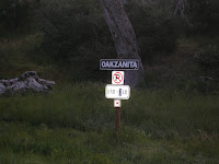
As I mentioned, this was an add-on to my Oakzanita hike, so the numbers below are altered some to include the distance to/from the Oakzanita Trailhead. The mileage won’t be exact either as I went off into the wrong direction for about 2 miles while I circumnavigated Sugg Peak trying to find a way up. Anyway, as I came down off Oakzanita and reached the trail junction, I turned right on my way to Sugg. And you may remember my comments about this other little sign at the Trailhead?

Sugg Peak is my destination from atop of Oakzanita. The peak on the left in the picture below is Sugg Peak and yep, it’s a fer bit out there.
This little hike had some very enjoyable miles including soft, grassy meadows and herds of deer to watch. The deer are hard to see in the bottom picture, but they were there…
If you’re walking along this trail and you come to a trail junction and the Fire Road, you’ve gone too far. I didn’t know this and headed on up the Fire Road looking for a way up Sugg. I kept getting farther and farther away, but my topo was showing an old road along Sugg’s ridge that just ended and I knew that couldn’t be true (later finding out yes, it was true. It simply ended). This is about where I left the trail and started directly toward Sugg knowing I was about to do some serious bushwhacking.
The first part of my trek was across a nice, grassy meadow and then I headed up the hill. This looked like a nice way to go.
Did I mention I had to get through some barbed wire fences? At first I was concerned I was getting onto private land and then I saw on my map that it was the boundary between Cleveland National Forest and Cuyamaca Park. Sure didn’t want to offend anyone out in the open country with no one around.
After the first fence or two, the going started getting a bit rougher. But I just know there is a trail here somewhere.
I continue on up and down pushing through and then I saw proof I was not the first person climbing up there (cairn on the rocks). Maybe I’m the first that took this particular route, but it was reassuring to know at least someone else did it the hard way as well.
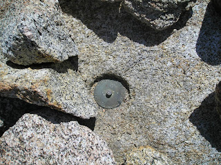
Then I got hopelessly lost in trying to figure out a way up. I was walking in circles and looking for any sign I could possibly find that other humans had been there in the deep brush. Suddenly, I spotted some dead branches that had been cut close to the ground. Then I started picking up on small limbs that had been cut long ago and started following them up the hill. There are always signs one can find or figure out whether it’s some trail angel or critter who has made a path for you. Finally, success as I was standing on the summit. I found the register, but I rarely ever sign them. So with that, I set off climbing all the rocks on the summit to find the old style benchmark that I saw on my topo. I climbed every darn rock up there and didn’t find it, so again I felt disappointed. But the hike itself was such a great adventure, it didn’t dampen my spirits. Besides, it was lunch time! I quickly renamed Sugg Peak to Suds Peak (bet I’m not the first to do that). J
As I sat there in quiet thoughts listening to the sounds of the back country without any man made sounds other than the occasional aircraft overhead, I was startled enough to come out of my shoes when I heard a voice that said, “Well hello there.” Holy smokes, I about choked on my sandwich!!! Don Raether who is another avid hiker had come up the draw between the two hills and then down over the top of the second mountain to get up to Sugg. We never saw each other until we met on the summit. After a few pleasantries and offering to take pictures for one another, I set off down the hill (ok, the real reason was I didn’t have any lunch left and I didn’t want to be tempted in asking him for some of his). He would have been in serious trouble if he had any Cheetos.
On my way down, I came across some tracks that looked really interesting. Yep, them there are mountain lion tracks. Can’t really tell in the pictures (but I have more coming in my Middle Peak report that are clear as day). The tell-tale sign that differs cat track from dog track is both size and the two middle toes. If the two middle toes are even, it’s cat track. If it’s offset like our fingers, then it is dog tracks. I left this picture larger for you so you can see it better. The track is about the size of my fist backhand and appears to be a day or two old, but not much older than that. The edges of the track were pretty crisp so the winds had not blown much of the sand granules around yet. These were the first mountain lion tracks I had seen in all my hikes so now I have my radars on and am looking in all directions. I left a stick to mark the area for Don so he could see them on the way down.
Just as I was walking away, Don hollered out for me and motioned for me to come back up. He had found the benchmark – under the register! (Note to self: always look under the register in the future.)
Don and I decided to hike down together and keep each other company so we could chat a little. We decided to take a path down neither one of us had used to come up knowing for certain it would be easier – boy were we wrong! But, we did find the old jeep road that just stopped without going anywhere and then we found GOD. Good to know he was around watching over us. We weren’t sure if we crossed over the line to the “Un-God” side, but that was the way home so off we went.
We pushed on down the hills pushing through the brush with Don in the lead sometimes and me in the lead sometimes. As I pushed through some chaparral about 6 foot tall, I saw him (or her) – BIG either way. We didn’t startle the rattler since it didn’t get alarmed, but anything that big wouldn’t be alarmed any way. I counted 9 rattle links before it started tapering off into smaller links (I counted these from my picture naturally, not while I was standing there). I saw the center of the body that had to be about 10 – 12 inches around. We obviously were in her living space and there were a lot more options how to get down off that mountain, so with a quickened step, we went around her – way around her. This was the first live rattler I had actually seen on my hikes so far; but I’ll bet it’s not the first one I’ve come across. They typically hear or feel you long before you get up on them and then they find a safe, secure place to hide and watch you go by. This is why I strike as many embedded rocks as I can with my hiking poles (causes vibrations in the ground so they can feel something is coming).
We finally pushed through and reached the meadows. I had taken a nasty spill and had cuts/scrapes all over with a softball size bruise on my hiney. Yes, it’s a good day so far. I last saw Don snacking on a PBJ on a fallen tree as I headed on to climb a couple more Peaks that day.
I will offer that this was one of the most adventurous hikes I’ve had so far and am enjoying myself immensely. Great exercise, connecting with the outdoors and enjoying the Lord’s work. Does it get any better than this?
Amazingly, I was still full of energy and it was just past noon by the time I got back to the trailhead, so I set off to conquer another two peaks (Stonewall and Middle Peak). Read about them as well. It ended up being a really good day.
Be safe, enjoy living and appreciate our lands. ~ Joel
Directions and the numbers:
Travel East on I-8 and exit on 79 North going about 6 miles to Julian (be watching for the 90 degree turn to stay on 79). At mailbox address number 11191 off 79, you’ll come to a parking area where the Oakzanita Trailhead starts. There are actually two trails that start here going in three directions, so be sure to follow the Lower Creek path. This is in the Cuyamaca Rancho State Park, so displaying an adventure pass is a good idea or you risk getting ticketed. An annual pass is only $35 or so and the monies go toward trail maintenance and other things. The daily pass is only $8. For the joy we get in return, it’s a worthwhile investment. Total round trip is appx 9 miles (I can’t be certain because I took a wrong turn and added some mileage, so I deducted what I thought was appropriate), 2063 total ascent with a max elevation of 5241 ft. Overall this took me about 4 hours.
Lat/Long:
32° 53' 2'' N; 116° 32' 30'' W
32.883942, -116.541559 (Dec Deg)
542882E 3638514N Zone 11 (UTM)
32.883942, -116.541559 (Dec Deg)
542882E 3638514N Zone 11 (UTM)


No comments:
Post a Comment