Lawson’s Peak and Gaskill Peak ©
2/10/2012, by Joel Hawk
So, you want to go on an 8 mile hike where you use rabbit paths and water-run-offs as your trail for the most part? For the rest of the hike, you don’t want any trail. And you want to climb over/under/around and through boulders as large as a house? And, you want to do a little rock climbing without gear but have the same risks? AND, you want views? Ok, have I got the hike for you!
I knew it was going to be a great day right from the start. One of the most interesting drives in all of San Diego County is along Lyons Valley Road. There are faster ways to reach the trailhead, but I took the back way for the full experience (OK, I didn’t know there was a faster way until I had completed my hike and came home another way)! While driving along you are met with lush green fields, back country properties complete with corrals, barns, livestock, and horses. Tight turns and neighbors who actually waved to me when I drove by (or was that a slowdown sign)? Nah, I was only going about 30 or so. Crazy cyclists coming around the corners about 25 miles an hour leaned all the way over toward the middle of the lane in their colorful garb. And hawks; man were there a lot of hawks – big ones. Not all in one area as they are territorial, but all along my ride. I haven’t been on a hike yet without seeing at least one hawk. Kind of makes me feel fuzzy and warm all over if you know what I mean.
After that fun drive, I found the trailhead. Carveacre is a jeep road and connects with Lyons Valley Road. There isn’t a parking lot anywhere close by, so it’s off-street parking and there are signs where folks have pulled over in the past, so that’s where I stopped. I was a little worried leaving my car there all day, but nothing had happened to my vehicle by the time I got back.


In looking at the first 100 yards or so of this hike (just past the yellow hummer), it looks like it’s going to be a pretty easy walk. The trail is marked so well that it’s easy to find – well, sort of. It’s close to mile marker 13 on Lyons Valley Road only there isn’t a mile marker 13 so this trip is already starting with a lot of guessing.
The hike starts along this non-maintained jeep road I’d mentioned complete with BIG ruts and water runoffs. About a mile into the hike, I make a turn and see my destinations for the day. Lawson’s Peak doesn’t seem to challenging; at least, not from here. Keep reading.

Gaskill’s Peak is still too far away to really judge the difficulty factor and I have to climb Lawson’s Peak before I decide whether or not I’m going to challenge Gaskill anyway. Looks doable and I could see the access road running about half way up the range. Gotta love Google Earth.

Nearing two miles into the hike, I came upon Castle Rock (the large smooth face in the center of the picture). Didn’t know that was the name until two hikers on the way down told me. So now I get to act like I know all the names. Well, there’s three that I do know and 1 that I made up. This dome doesn’t look to intimidating so I think I’ll climb it on the way to Lawson’s Peak.

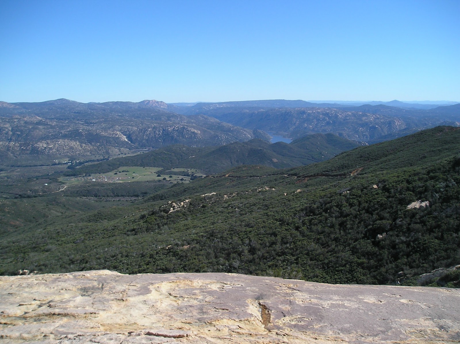
This is from the top of Castle Rock looking out at Barrett Reservoir toward the SE. That little line in the greenery on the first hill on the right was my trip up so far.
I’ve come to realize most of my initial assessments are going to be challenged for the rest of the day at this point. The size of this rock is about two stories high (one story is the one I’m telling you now and then there’s the real one). The vertical pitch on this is really steep. I had to slide from rock to rock on the left side sitting on my hiney to get down. I had dropped my poles long ago on purpose so I could use both hands, feet, hiney, legs and back as drag. Having a large body mass offers more drag than most folks. Sliding down this baby caused me to wonder how I was going to get back, but I knew I’d figure it out. Haven’t had a wedgie in years….can’t say that now.

I was ill-prepared for how steep the climb up to Lawson Peak was going to be. I was worse than the wolf chasing the three little piggies with all the huffing and puffing. During one of my stops for much needed air, I looked at the ground a little closer and saw the bright green, three leaved poison oak plant. I really peeled an onion for that plant more after seeing this one. I never even noticed the barbed wire until I saw it here in the picture. There wasn’t much fence out there where I was and I didn’t see any strung up anywhere else on my trip, so that was puzzling.

Jerry Schad wrote in his book, Afoot and Afield, about having to crawl through a cave. It’s the small triangle at the bottom. One would think it’s pretty easy to just climb over those rocks, but they are much bigger than they appear here in this picture. I bushwhacked around these boulders and picked up the trail on the other side. Climbing though that cave was just a bit tight for a Big Boy like me. I wasn’t scared about what was in there, but I wasn’t going to find out either.

There are definitely those with good rock climbing skills and they were able to get up onto the top of this rock, but I wasn’t one of them. After walking all the way around as much as I could, I settled for “touching” these monster boulders and called it a success. Course, not falling off that boulder was a success too.

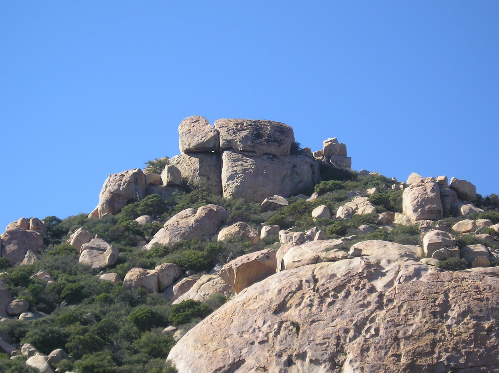
Some very interesting rock formations and I was compelled to climb to the top of it, but without any ropes I decided to press on to Gaskill’s Peak.

There wasn’t really a trail to follow for the most part. Here is some of it.

Hmmm, I think that’s Gaskill’s Peak. That’s what the GPS says anyway. I zoomed in so I’m still a long way from this baby.
Yep, that was Gaskill. I made my way around to the back and could not find any way up. Determined to get to the very top of this peak, I crawled, slid, climbed, pulled on manzanita bushes so I could get to the 8 foot vertical face on this thing. Again, determined to have my lunch at the top, I started climbing. If you look at the last picture, I climbed the top rock from this side and from the right hand corner. Yes, I did look down a couple of times after I made that decision, but I made it and was rewarded well for my efforts. I didn’t know there was a survey marker on top.

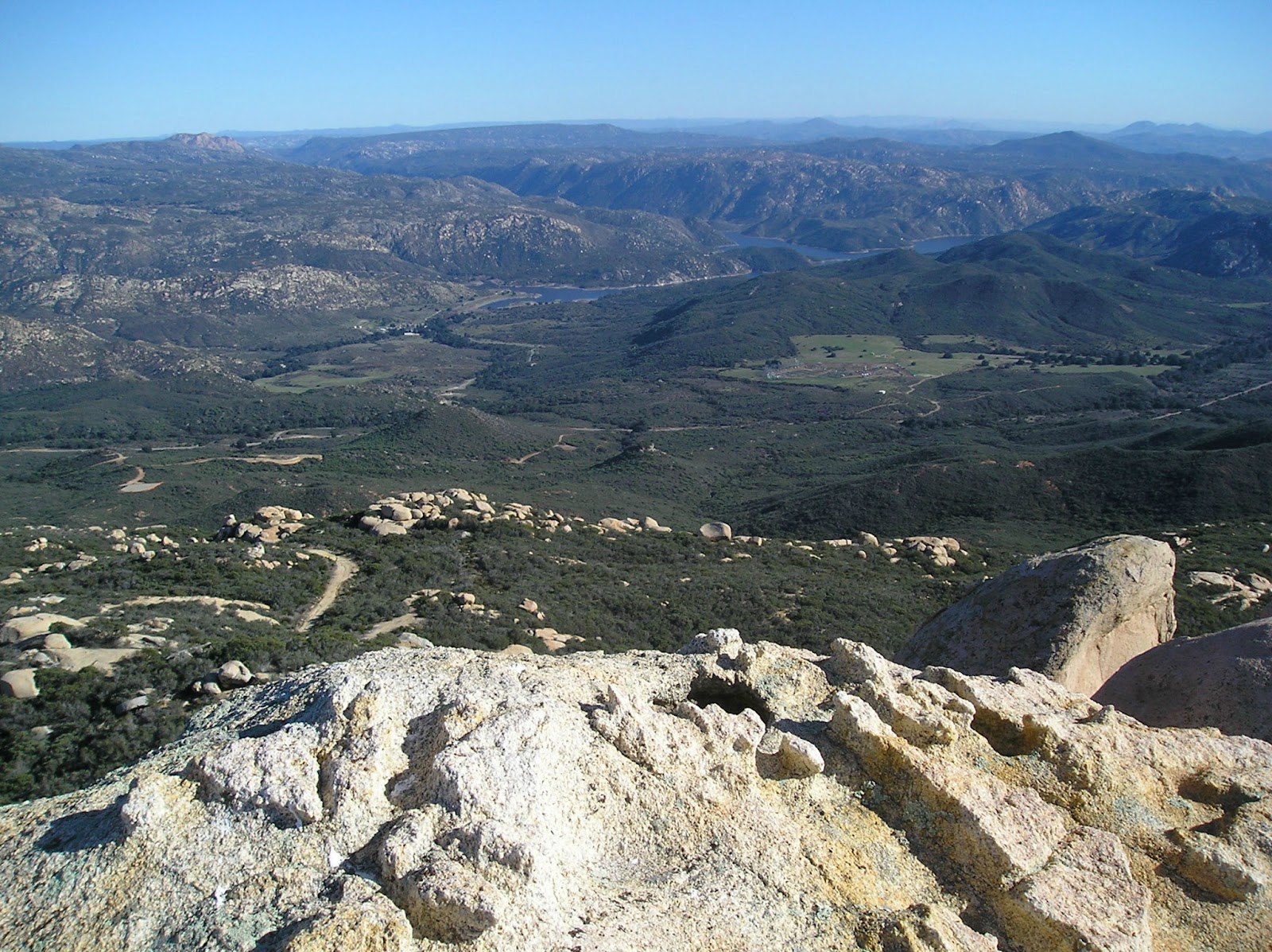
Did I mention views?
Guess why I was smiling? I was about to eat!!!!

While having a bite, I kept having this feeling I was being watched. Yes, there were ravens and hawks and all kinds of normal wildlife around me, but that wasn’t it.

Then I saw it. I was being watched by an ALIEN!!!

Lunch is over and it’s time to head back. Now where was that trail?

On the way back, I found the “real” trail I think. At least someone had taken the time to put these rocks in an arrow formation. If you take this trail, let me know if it takes you up to the top. If it’s a good trail and you want to experience some of my adventures, there are a lot of rocks out there to climb. Did I say it was a gorgeous day? It was…

Be safe, enjoy living and appreciate our lands. ~ Joel
Latitude/Longitude (WGS84)
Lawson Peak
32° 43' 35'' N; 116° 43' 34'' W
32.72634, -116.726021 (Dec Deg)
525673E 3620983N Zone 11 (UTM)
32.72634, -116.726021 (Dec Deg)
525673E 3620983N Zone 11 (UTM)
Gaskill Peak
32° 44' 20'' N; 116° 42' 59'' W
32.738991, -116.716495 (Dec Deg)
526562E 3622388N Zone 11 (UTM)
32.738991, -116.716495 (Dec Deg)
526562E 3622388N Zone 11 (UTM)
Great post and the pictures helped out a lot! Hiked it this past weekend and it was great. I blogged about it on my website. Also, there are pictures and videos from there. Great job!
ReplyDeleteXtremeHikers.com
I live on carveacre on the north east side of gaskill peak. Just moved in and haven't had time to hike it yet! Great pictures and story!
ReplyDeleteI live on carveacre on the north east side of gaskill peak. Just moved in and haven't had time to hike it yet! Great pictures and story!
ReplyDelete