Wild Horse Peak ©
May 26, 2012 by Joel Hawk
Waking at 2:30 a.m. to go hiking is the first indicator this was going to be a big day. Rolling out of the rack by 3:00 only confirmed the commitment made to a 20+ mile hike. Although the weather guessers promised nice weather, our original intention was soon to be changed by Mother Nature. It was raining off and on with high, gusty winds. I had excited hopes things would settle down by the time we drove 67 miles and got on the trail around 6. My hiking buddies were Jack “Motor” DeFranco and Uwe “Man Beast” Luettringhaus. Although suffering from a torn calf muscle, I felt up to the hike and since we had planned it for so long, I thought I would go as far as I could and turn back if I had to. Fortunately, by the end of the hike, my calf was fine although everything else hurt like heck!
This is true wilderness and the likelihood you’ll see anyone else (human) hiking this trail may be slim, although it does look used quite a bit. It may have just been the weather that kept the other hikers at bay, but we were all excited about the day adventure ahead. You are required to register yourself/party before starting the hike as a “just in case” procedure.


I have sold real estate for years and one of the mandatory disclosure requirements is to disclose any known presence of the Arroyo Toad. I’ve never even known where this toad lived, but now I do. Guess I won’t be selling any homes in the Cleveland National Forest anytime soon, but at least now I know where this fella lives. One thing I do know, that Arroyo Toad “barked” a lot along the trail. Lots of info right in the beginning, but it’s better to read everything posted for your safety’s sake and remember to jot down the Rangers phone number just in case. As much as I hike now, it’s on my speed dial, but in case of emergencies, please put this number in your phone (619) 557-5262.


Unknown to me, we’ll be walking around those mountains in just a few hours. I was trying to figure out where Agua Tibia was and still could not see it off in the distance. Turns out, we were not able to see the peak from where we were; however, we were encouraged early on in our hike by the splotches of blue skies teasing us the weather was turning for the better.


We are looking at Vail Lake to the North from a lower elevation. It’s a much prettier site higher up. The dark green spot is Dripping Springs camp ground where our cars are parked.
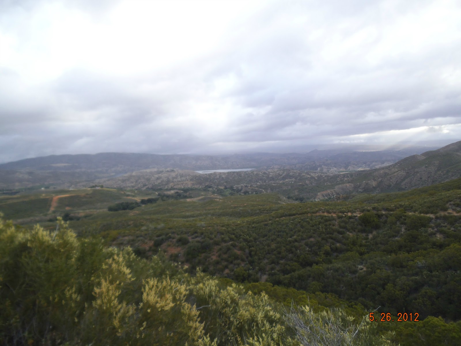

We made a turn and had our first siting of Agua Tibia. Sure looks a long way off with the cloud covering the very top.


As I mentioned, the trails are in great shape and very easy to follow. I only took one wrong turn but quickly figured it out since there were no footprints on that trail. There were still some clouds and wind, but big promises of a great day.


What an interesting rock below. This is granite where at some time in the past, molten lava pushed its way up to melt it and over time, got the rock to the surface so we could enjoy seeing it. I find it amazing that this close to us in So Cal, things can get this hot.

After a few miles of checking things out, the weather started turning for the worse. We were hoping it wouldn’t rain, but the temperature dropped and we got wet as we hiked through the brush. The Rangers/Trail Angels did a great job of cutting back the overgrowth creating a no-kidding tunnel through the underbrush, but they must all be about 5’2” or so. The three of us stand 6’ plus and we were soaked from the moisture falling onto us. There were a number of downed trees we had to climb over/under/around. Our fingers were getting so cold and we were shivering so taking pictures became a “not-so-important” thought. Here are a couple of pictures to show you we were walking through the clouds and were some very wet, cold and tired puppies.


We reached the area where we thought we would turn off the trail to bushwhack up to Agua Tibia Peak, but as cold and wet as we were and with the uncertainty of the weather, we decided to opt for the safe route and come back some other day. There simply was no easy way up the peak without intense bushwhacking, so we turned this hike into a scouting trip instead.
I’ve been asked on occasion why I go to all these places and hike so much. I think that nature is beautiful and although I artificially bring pretty plants into my yard like roses, wisteria, agapanthus, flowing trees, etc., I am stunned at the natural beauty all plants are in the wilderness. They don’t need the fertilizers and imported water to provide us with a stunning display of color. My walks are always enriched by the fragrances and beauty of these plants. Have a look, enlarge the photos and enjoy a snapshot of beauty in time. Some of these flowers are growing right out of a small fissure in the rock walls. There were so many colors on this hike; pink, red, blue, purple, white, yellow, orange along with the different hues as the color transitions from one main color to another.


This was part of the hike along the Wild Horse Trail after we climbed down off Agua Tibia Trail. This is where we started drying out. You can’t tell, but the forest is to the right of this picture and the ground just falls off into the canyon floor. The trees are very old and very tall. Wish I had taken some additional pictures to show you, but somehow, I think I’ll be going back sometime soon or again in the Spring when there is more water flowing (and hopefully, not dropping on us).

There were two running creeks we crossed (that I remember), but frankly even with the rains of the night before, there wasn’t much in the way of water resources out there. Be sure to take plenty of water. I consumed 4 liters easily on a cool day – just so you know!


We reached the trail junction of Wild Horse Trail and Crosley Road. We may plan to jeep our way back to this spot if we can when we come back to bag Agua Tibia and Eagle Crag. Although I didn’t get a picture of Eagle Crag, it looked spectacular with its sheer rock face even with the clouds. I look forward to the return trip and hope we can do it soon.

We were making our way around the final leg and stumbled upon what looked like an old water pump shelter. We decided to leave the trail for a bit to go discover what was down there and found out this was an old truck bed. It looked like this area had become a dumping ground for a period. I found an old Jim Beam decanter from 1971 (broken and empty darn it).


As we continued to discover the area, we found some survey signs and a benchmark. We think it could have been the Agua Tibia Benchmark, but I’ll have to research it some more.


Spotting another sign, Uwe bushwhacked up to it to see what it was. That was the last we saw of him – just kidding….interestingly, we left the area to the hooting of an owl.

I did mention the trail was well maintained and that is true for the most part, but there was this little area where walking over rocks was required. I couldn’t tell if it was a landslide or manmade, but I didn’t waste any time getting from one side to the other. I moved quickly to get back onto the tail and took a little shade break.


Sometimes we get caught up on the trail just looking at the trail for perils, but it’s important to remember you’re there for the journey; not the destination. This is looking toward the Northeast out at the desert area of Radec and Lancaster Valleys. The second picture looks at the Palomar Observatory (the small white dot on the horizon just to the left of the center of the picture. If you click on the picture, it will enlarge).


I wish I had taken a shot of the dense brush we bushwhacked through to get to the top of Wild Horse Peak, but I didn’t so you’ll just have to take my word for it. This was what I would rate a 10 in difficulty without the use of ropes or other assist devices. I was sliding going both up and down and I gave it a ten because it took ALL of my determination to keep going all the while knowing the going up was the easy part. I knew I was going to do the hiney-slide on the way down and I was right. I gotta get some padding in those pants….Motor at the top of Wild Horse Peak having a snack.


Did I say this was a pretty hike? Just gorgeous is all I can come up with.

Ah, our reward for a great day in the wilderness. I can’t thank my friends enough for their companionship and stories we share along the trail. Jack, you got so wet, you shrunk!

As a bonus, this is some art work just off of 79 just before Dripping Springs. Beautiful silhouettes of the wild horses.

Be safe, enjoy living and appreciate our lands. ~ Joel
Directions and the numbers: Travel East on CA-79 off of I-15 for 10.4 miles. You can park in the Dripping Springs camp grounds. Be sure to either take your Adventure Pass or you can pay the $5 daily use fee. We took the Agua Tibia Trail and turned it into a long loop catching up with Wild Horse Peak Trail. The total hike was 22.1 miles with a 4557 total ascent with a max elevation of 4702 ft. Overall this took me 10 hours, 37 minutes of moving time.
Latitude/Longitude (WGS84)
33° 26' 30'' N; 116° 57' 27'' W33.44162, -116.957599 (Dec Deg)
503941E 3700248N Zone 11 (UTM)
HI,
ReplyDeleteWow, this is beautiful! You're really captured the style of these horses, and their history is so fascinating! Lovely job :)
Horse Decanter