Monday, July 30, 2012

Sugg Peak

Sugg Peak ©
May 6, 2012, Joel Hawk
After my Oakzanita adventure, I added Sugg Peak so this fun little tale starts at the junction where the two trails meet.  In my Oakzanita report, I mentioned, “What a nice, comfortable hike recommended for the entire family”.  Not so for this one – and please hear what I’m saying.  
This hike is for the seriously delusional, open country hiker who starts with no idea how to get there, who needs no trails to follow and actually wants to succeed in standing on the summit.  The reward is figuring it out, but if you don’t have thick skin to survive the bushwhacking, the perseverance to continue pushing forward and upward or if you have fear of rattlers and mountain lions, you may want to pass on this one.  Oh, and there are barbed wire fences to climb over.  Told you this hike was fun!
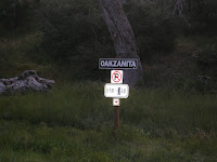
As I mentioned, this was an add-on to my Oakzanita hike, so the numbers below are altered some to include the distance to/from the Oakzanita Trailhead.  The mileage won’t be exact either as I went off into the wrong direction for about 2 miles while I circumnavigated Sugg Peak trying to find a way up.  Anyway, as I came down off Oakzanita and reached the trail junction, I turned right on my way to Sugg.  And you may remember my comments about this other little sign at the Trailhead? 


Sugg Peak is my destination from atop of Oakzanita.  The peak on the left in the picture below is Sugg Peak and yep, it’s a fer bit out there.

This little hike had some very enjoyable miles including soft, grassy meadows and herds of deer to watch.  The deer are hard to see in the bottom picture, but they were there…


If you’re walking along this trail and you come to a trail junction and the Fire Road, you’ve gone too far.  I didn’t know this and headed on up the Fire Road looking for a way up Sugg.  I kept getting farther and farther away, but my topo was showing an old road along Sugg’s ridge that just ended and I knew that couldn’t be true (later finding out yes, it was true.  It simply ended).  This is about where I left the trail and started directly toward Sugg knowing I was about to do some serious bushwhacking.
The first part of my trek was across a nice, grassy meadow and then I headed up the hill.  This looked like a nice way to go.

Did I mention I had to get through some barbed wire fences?  At first I was concerned I was getting onto private land and then I saw on my map that it was the boundary between Cleveland National Forest and Cuyamaca Park.  Sure didn’t want to offend anyone out in the open country with no one around.
After the first fence or two, the going started getting a bit rougher.  But I just know there is a trail here somewhere.

I continue on up and down pushing through and then I saw proof I was not the first person climbing up there (cairn on the rocks).  Maybe I’m the first that took this particular route, but it was reassuring to know at least someone else did it the hard way as well.
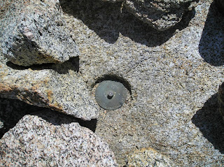
Then I got hopelessly lost in trying to figure out a way up.  I was walking in circles and looking for any sign I could possibly find that other humans had been there in the deep brush.  Suddenly, I spotted some dead branches that had been cut close to the ground.  Then I started picking up on small limbs that had been cut long ago and started following them up the hill.  There are always signs one can find or figure out whether it’s some trail angel or critter who has made a path for you.  Finally, success as I was standing on the summit.  I found the register, but I rarely ever sign them.  So with that, I set off climbing all the rocks on the summit to find the old style benchmark that I saw on my topo.  I climbed every darn rock up there and didn’t find it, so again I felt disappointed.  But the hike itself was such a great adventure, it didn’t dampen my spirits.  Besides, it was lunch time!  I quickly renamed Sugg Peak to Suds Peak (bet I’m not the first to do that).  J
As I sat there in quiet thoughts listening to the sounds of the back country without any man made sounds other than the occasional aircraft overhead, I was startled enough to come out of my shoes when I heard a voice that said, “Well hello there.”  Holy smokes, I about choked on my sandwich!!!  Don Raether who is another avid hiker had come up the draw between the two hills and then down over the top of the second mountain to get up to Sugg.  We never saw each other until we met on the summit.  After a few pleasantries and offering to take pictures for one another, I set off down the hill (ok, the real reason was I didn’t have any lunch left and I didn’t want to be tempted in asking him for some of his).  He would have been in serious trouble if he had any Cheetos.
On my way down, I came across some tracks that looked really interesting.  Yep, them there are mountain lion tracks.  Can’t really tell in the pictures (but I have more coming in my Middle Peak report that are clear as day).  The tell-tale sign that differs cat track from dog track is both size and the two middle toes.  If the two middle toes are even, it’s cat track.  If it’s offset like our fingers, then it is dog tracks.  I left this picture larger for you so you can see it better.  The track is about the size of my fist backhand and appears to be a day or two old, but not much older than that.  The edges of the track were pretty crisp so the winds had not blown much of the sand granules around yet.  These were the first mountain lion tracks I had seen in all my hikes so now I have my radars on and am looking in all directions.  I left a stick to mark the area for Don so he could see them on the way down. 
Just as I was walking away, Don hollered out for me and motioned for me to come back up.  He had found the benchmark – under the register!  (Note to self: always look under the register in the future.)
Don and I decided to hike down together and keep each other company so we could chat a little.  We decided to take a path down neither one of us had used to come up knowing for certain it would be easier – boy were we wrong!  But, we did find the old jeep road that just stopped without going anywhere and then we found GOD.  Good to know he was around watching over us.  We weren’t sure if we crossed over the line to the “Un-God” side, but that was the way home so off we went.
We pushed on down the hills pushing through the brush with Don in the lead sometimes and me in the lead sometimes.  As I pushed through some chaparral about 6 foot tall, I saw him (or her) – BIG either way.  We didn’t startle the rattler since it didn’t get alarmed, but anything that big wouldn’t be alarmed any way.  I counted 9 rattle links before it started tapering off into smaller links (I counted these from my picture naturally, not while I was standing there).  I saw the center of the body that had to be about 10 – 12 inches around.  We obviously were in her living space and there were a lot more options how to get down off that mountain, so with a quickened step, we went around her – way around her.  This was the first live rattler I had actually seen on my hikes so far; but I’ll bet it’s not the first one I’ve come across.  They typically hear or feel you long before you get up on them and then they find a safe, secure place to hide and watch you go by.  This is why I strike as many embedded rocks as I can with my hiking poles (causes vibrations in the ground so they can feel something is coming).
We finally pushed through and reached the meadows.  I had taken a nasty spill and had cuts/scrapes all over with a softball size bruise on my hiney.  Yes, it’s a good day so far.  I last saw Don snacking on a PBJ on a fallen tree as I headed on to climb a couple more Peaks that day. 
I will offer that this was one of the most adventurous hikes I’ve had so far and am enjoying myself immensely.  Great exercise, connecting with the outdoors and enjoying the Lord’s work.  Does it get any better than this?
Amazingly, I was still full of energy and it was just past noon by the time I got back to the trailhead, so I set off to conquer another two peaks (Stonewall and Middle Peak).  Read about them as well.  It ended up being a really good day.
Be safe, enjoy living and appreciate our lands.   ~ Joel
Directions and the numbers:
Travel East on I-8 and exit on 79 North going about 6 miles to Julian (be watching for the 90 degree turn to stay on 79).  At mailbox address number 11191 off 79, you’ll come to a parking area where the Oakzanita Trailhead starts.  There are actually two trails that start here going in three directions, so be sure to follow the Lower Creek path.  This is in the Cuyamaca Rancho State Park, so displaying an adventure pass is a good idea or you risk getting ticketed.  An annual pass is only $35 or so and the monies go toward trail maintenance and other things.  The daily pass is only $8.  For the joy we get in return, it’s a worthwhile investment.  Total round trip is appx 9 miles (I can’t be certain because I took a wrong turn and added some mileage, so I deducted what I thought was appropriate), 2063 total ascent with a max elevation of 5241 ft.   Overall this took me about 4 hours. 

Lat/Long:
32° 53' 2'' N; 116° 32' 30'' W
32.883942, -116.541559 (Dec Deg)
542882E 3638514N Zone 11 (UTM)
Thursday, July 26, 2012

Bernardo Mountain

Bernardo Mountain ©

12/30/2011, by Joel Hawk
It was a gorgeous day when we awoke for our hike.  We had planned a family day with Chris and our friends, Dustin, Jessica and Tanner (along with their two dogs, Jake and Paco).  We parked at the trailhead across from Sikes Farmhouse by North County Fair Mall.  The first part of the hike is along a paved path running parallel to the I-15 on the Eastern side.  This is the only part of the hike one could really do without.  As we walked South, we could look out over East Lake Hodges and toward the early morning sun as it bathed us in warmth.  There was a slight fog in the air, but this soon cleared up.

We walked under the I-15 through a pedestrian “cross-under” bridge which I never knew existed.  This does make traveling from one side of the freeway to the other very convenient and safe.  The trail is open to hikers, runners, dogs, horses and bicycles so be on the lookout.  As we walked along the bank of Lake Hodges, we began to notice a lot of bird activity and noticed a number of folks had already started their day with a bit of exercise.  Coming upon about ¾ of a mile or so, we saw the pedestrian bridge that spans across Lake Hodges from North to South.  What a beautiful bridge and again, protects pedestrians and cyclists from having to use the freeway to cross over the Lake.
Our goal of the day was to climb Bernardo Mountain.  The mountain is ranked number 100 of 100 peaks of San Diego on www.peakbagger.com.   The trail is clearly marked and in good shape all the way up/down becoming more narrow once we started our ascent.  I would recommend this hike for all the family.
As we rounded the turn, we saw just how beautiful Lake Hodges really is and all the wildlife that lives here right in our own backyard.  This egret was off into the field by itself, but as you may be able to see in the following picture, there were a lot of birds living in/on the lake.  If you are a "Birder", you will enjoy the different species of birds you can identify and is a sight you should go see.  If you're not a "Birder" you will still enjoy seeing all the different kinds of birds that live right here next to us.

We left the trail to start heading up the mountain and was quickly met with a beautiful, easy creek crossing under some majestic, old oak trees.  Everyone navigated the crossing well and looks like Jake had the most fun since he actually got wet.  Paco wanted no part of crossing by himself, so Jessica carried him over.  I was wondering who was going to carry me?  Tanner looked interested at first, but he stayed on that side of the creek.

Although we were just now coming upon a little over a mile into our hike, this bench in the cool shade with the babbling brook just behind it really looked inviting.  Great place for a sandwich and a few stories for the next time though.
Coming up to our turn, we left the trail that goes around the lake to the North to start our ascent.  I continue to appreciate all those who make our hikes and explorations of nature so wonderful and convenient.  Well-marked signs are just another way others have helped us discover and enjoy our surrounding area.

I mentioned to Dustin that I measure the success of my hikes by whether or not I see any hawks.  Within just a few minutes a beautiful red-tailed Hawk flies over the creek and lands in a tree to survey the best opportunities for a quick breakfast.  With wide eyes, Paco stayed close to mom.  I was amazed at all the beautiful birds and signs of wildlife that we saw.  There were the black and white woodpeckers, gnatcatchers, robins, hummers, finches and I’m sure many more that I didn’t see or recognize.  Tanner spotted some deer tracks and a number of animal trails that crossed over our hiking trail. 
As we wound our way around the mountain through the California sage and brush, we could see remnants of the 2007 Cedar fire which ravaged much of San Diego County destroying so much natural habitat, many homes and taking 15 lives.  A very sad, human induced tragedy that only now has the landscape started returning back to the way it once was.
With homes all around us, we were able to take a short stroll and reconnect with the beauty San Diego has to offer – and get a little exercise as well.  This was the hardest part of the trail, but is very doable for the recreational hiker.  Tanner is only 8 years old and climbed the mountain like a well-seasoned hiker.  This stretch of loose rocks is only about 50 - 75 yards long.
Once we climbed through the rocks, we came upon some citrus and sage smells.  Although not very high or dense, one could get a feeling of walking through the brush if only for a short distance.  This certainly offered a sense that one was "getting away" even if for only a little while.
Within only 1 ½ hours, we had reached the summit and enjoyed a nice lunch overlooking some of the wonders we can enjoy in our own backyard.  As we sat there, a number of beautiful flutter-bys joined us bringing us even more smiles.
Sadly, after 20 – 30 minutes, we started our way back down and back to the hustle/bustle of modern society.  These short escapes are among us and are very close by.  Be sure to savor each opportunity as they enrich our lives and ground us with nature.  Chris and I really enjoyed the companionship of our friends and the stories we told.


Be safe, enjoy living and appreciate our lands.   ~ Joel
Latitude/Longitude (WGS84)
33° 3' 50'' N; 117° 5' 17'' W
33.063921, -117.08804 (Dec Deg)
491782E 3658377N Zone 11 (UTM)

Friday, July 20, 2012

Viejas Mountain

Viejas Mountain ©

3/10/2012, by Joel Hawk
Recovering from a hard fall earlier in the week, I wanted a short, easy hike to get outside and stretch my legs.  In my research online, I found a 3.4 mile hike with an elevation gain of 1460 ft.  So with my trusted and beautiful fiancée Chris, off we went.  Well, one out of two of my hike requirements wasn’t bad.  Don’t let the short distance trick you like it did me.  The ascent is challenging, but well worth the views.  Experiencing this new adventure makes one almost forget the steep climb and loose rock trail.  With patience, this would be a good family hike.
Part of the adventure is simply finding the trailhead.  The directions in Jerry Schads book, “Afoot and Afield,” are a little off, but with some common sense, one could find their way if needed.  These directions are a little clearer.  Take Tavern Road South off of I-8 for 0.1 miles (I would almost take any road named Tavern Road just to see where it would go, but I may not get much hiking in).  Turn left (East) at the red light on Alpine Blvd and go for about 0.7 miles where you will turn left onto Victoria Dr.  Drive over I-8 along Victoria Dr for about 1.1 miles and turn left onto Anderson Road which eventually turns into Anderson Road Truck Trail.  About 0.5 miles on Anderson Road (Truck Trail), you will pass two large water tanks (if not, you’re on the wrong road – turn back).  Continue on for about 0.3 miles and you will see a small parking area/turn out on the left.  The trailhead is a small opening in the fence and is nicely pointed out by my companion, Chris.  You can’t see the summit from here, but as she points out, it’s in that direction.


The ascent is steep with really loose rocks so be sure to wear good, solid hiking shoes/boots and take a hiking stick or poles.  These will save your hiney coming back down and will provide balance for you on the way up.  You may want to consider long pants or a zip-away for some of the brush that is overgrowing the trail.
Total travel time up was 1 hour, 12 minutes at a reasonable, comfortable pace.  The day was hazy so we couldn’t see the ocean, but could make out the skyline of Point Loma.  No doubt on a clear day one will be able to see the ocean all the way to the horizon.  The trail is clearly marked all the way up without any side trails meeting up although at one point Chris asked if I was sure we were on the trail or not.  We were crossing over some larger rocks along the ridge, but the trail picked up on the other side.
Once you reach the top of the ridge, the trail does go North/South.  If you’re a survey marker hound like me, turn South (right) as you reach the ridge and climb to the top of the second peak about 75 – 100 yards away.  This was the first Azimuth marker we found on the day.  Azimuth markers point toward the benchmark which we did not find.  It appears the Azimuth markers were moved around at some point over time so they no longer pointed in the correct direction.

Surprisingly, we found three Azimuth markers with Chris finding her first one without me (pics below).  Now she’s hooked as well and I suspect will be climbing to the top of very large boulders soon looking for these little gems.  (I just heard in the background that “that” was not going to happen!  I’m surprised she doesn’t want to climb the large boulders with me.  Hmmm.)
After my little jaunt to the Southern View point, we headed North to the summit which used to be a winter-solstice marker built by the Kumeyaay Indians a long time ago.  The story goes like this.  The solstice was pointed directly at Buckman Peak toward the Southeast.  The Kumeyaay would dance as the sun rose behind Buckman’s Peak during mid-December until it was directly behind the peak on Dec 21.  Sadly, campers in the 70’s destroyed the monument and folks have begun building a windbreak out of rocks over the years.  I can’t state these are true facts because I wasn’t there, but this is what I’ve picked up over the internet, so it must be true right?  The “new” windbreak is below in the picture at the summit.

While at the summit/windbreak, this is where the other two survey markers appropriately marked #1 and #2 were found.  I’ll refrain from telling you exactly where we found these so you can have a sense of adventure in finding them yourselves (but call me if you need to and it will be our little secret).


Be sure to take a lunch or snack as you take in the views.  You’ve earned them from that climb up!  Just below and to the East is Viejas Casino and immediately to the South is Bell Bluff.  Farther South is Mexico and all around you are exciting peaks awaiting your calling.  Just pick one or two for your next adventure and get outside to enjoy life. 


Looking NW, one could see the very prominent face and sheer cliffs of El Capitan and El Cajon Mountain with short glimpses of the El Capitan Reservoir down below. (I took this picture on the ascent, so you can’t see the reservoir from this height.)

What a striking sight to see.  I proudly boasted to Chris about which peaks I had climbed over the last few months.  I’m not sure if she was impressed or not, but it was a cool story.  The temperature was very mild with a gentle breeze keeping us right on the verge of almost warm to being chilled.  It was a very comfortable day for a hike.  While sitting in the windbreak looking around at the marvels in our own backyard, one could hear the quiet of nature along with occasional, distant and comforting sounds of small aircraft as they land or take off at Gillespie Field in El Cajon.
The wildlife was pretty typical for a heavily traveled trail.  We saw our good luck charm, “The Hawk,” ravens, grasshoppers, lizards, a horned toad (picture below), and lots of flutterbys.  The butterflies were in all sizes, shapes and colors and we saw two flying in tight circles going around each other climbing vertically for 15 – 20 yards during their mating dance.  It’s always fun to see the wildlife even on such a small scale.


The trip back down was uneventful and almost tedious with the loose rocks.  At one point we were both dancing down the trail trying to remain upright with the loose stones beneath us.  Fortunately, we didn’t fall, but as I said earlier, I highly recommend good hiking poles for balance.
Obviously, our trip down was much faster than our trip up.  I wonder if it was because we were thinking of how good that margarita and lunch was going to taste at Murrietas or if it was just my mass in motion?  And the food/marg was very good, but that’s another story….

Be safe, enjoy living and appreciate our lands.   ~ Joel
Elevation Info: NAVD88 Elevation: 4189 ft / 1277 m

Latitude/Longitude (WGS84):
32° 51' 40'' N; 116° 43' 34'' W
32.861245, -116.725978 (Dec Deg)
525638E 3635938N Zone 11 (UTM)

Sunday, July 15, 2012

San Gorgonio Bagged 7/14/2012

Pre-Article, San Gorgonio Mountain ©

July 15, 2012, by Joel Hawk

Just bagged San Gorgonio at 11,503 ft.  Article already in the works...this is a must hike if you're working up toward Mt. Whitney.  Very challenging and very rewarding.  Strike the pose!


Someone made and left a very cool sign for folks to use when taking their pictures.  What a cool idea!  This is my buddy Jack "Motor" DeFranco.


More to come soon...stay tuned in.