I had heard about this fun hike through some friends and it was time for some more exploring. So, Chris who we call “Warrior” and I decided to take the jeep on a little drive, so off we went.It’s about 2 ½ hours out of San Diego and along some pretty scenery.With the safari top on and some nice music, we set off on our adventure.Along the way on 79, we saw some very creative art along the road.I had seen some horses before and posted about them, but there have been some very cool additions since then.
After a very enjoyable trip, we arrived in Idyllwild, found the Ranger Station and got our required but free permit. With permit in hand, we set off for the Nature Center/Deer Springs Trail and our hike.
This is a well maintained and heavily traveled trail and is recommended for the family. A little steep in some places, but a very nice walk in nature.
I'm not sure what flower or fungus this is, but how pretty the bright reds are against the browns of the forest.
The trails start off in the State Park and then cross over into the San Jacinto Wilderness, but all the trails are well maintained. If you hike far enough, you will cross over the famous Pacific Crest Trail. We didn't do that on this day.
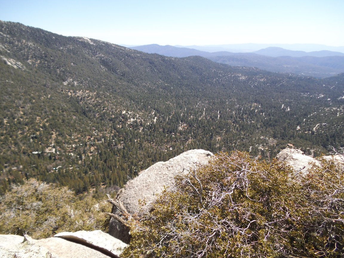
The views are incredible and it was such a perfect day for a hike. All days in So. California are like this. ;)
We traveled along the very shady trail with gentle breezes keeping us from getting very hot. Chris mentioned she heard water running and we soon came upon this very nice and natural water feature the Lord provided.
We reached the trails end and started looking around. There were a number of people there having a snack and some were tight-roping. They were out of sight, so no pics, but man, that's gutsy to be up that high and practicing their tight rope skills. I kept looking for the "real" suicide rock because everything I was finding just could not have been the spot where those two Indians jumped. In my research, I came to learn the entire rock structure is called Suicide Rock. But, to sweeten this fable, here are a few story lines I found online describing how it "really" goes about these two lovebirds (it's a Romeo and Juliet story - only Indian).
(Paraphrased) An American Native Princess met and fell in love with an Indian Brave from another tribe. Her father forbid the relationship, but she loved and ran away with the Brave anyway. Hearing this, the father sent other members of the tribe out to find his daughter and kill the Brave. The Princess did not want to live without the Brave, so they jumped to their deaths together off of Suicide Rock. So the story goes....
I searched for the logical jumping site and could not find anything or anywhere that made sense. So I continued on around some large boulders and found a spot worth investigating. Getting to it is very risky...getting back up is even more risky. But I skinnied down to this 4 x 6 ledge and peered over. Man, that took my breath away as it was straight down for a very, very long way. I could not see the face of the rock...just open air and the tops of the mature pine trees way the heck down there. Chris took a couple of pictures of me since I left my camera up on top - big mistake. The first shot below is how far down I had to climb to get to the ledge and the second is zoomed up as much as she could get. I was sitting because honestly, I was a little scared. Right behind where I was sitting under the pine limbs were two rusted chain links where others were climbing over the face. Wow! No signs of recent activity, but if there was a spot to jump, this was it.
I say it was a mistake that I didn't take my camera with me because, after climbing back up, I wasn't about to do it all over again. I don't use ropes or chains, so you can understand my concerns. However, I did take this video as best as I could. This is my first attempt in including video in my blog, so maybe in the future they will be better.
As I had mentioned before, the scenery is stunning.
Looking across the valley, you can see Lilly Rock and Tahquitz Peak. Tahquitz Peak is on my list to do someday.
What a fun way to spend the day. Good health to you and yours. Live life to the fullest.
Be safe, enjoy living and appreciate our lands.~ Joel
Directions and the numbers:
Travel to Idyllwild Ranger Station in town and pick up your free permit.Then, continue to Idyllwild Nature Center and park across the street or park in the parking lot (it will cost $5).The trailhead is just across the street from the Nature Center.Total round trip is appx 7 miles, 1700 total ascent with a max elevation of 7528 ft.Overall this took us about 4 hours.
You will need to purchase an adventure pass to park at the trailhead. This can be accomplished at the Forest Service Visitor Center and at the gas station in town, as well as other local businesses.
I have to say that the information here was the most complete that I found anywhere. I am definitely bookmarking this to come back and read later.Your website is very chatty. It will be useful for all of us. You have done a work. I will come here again to inspect new updates. Thanks for postin.I have explain all the comments and suggestions posted by the visitors for this article are very good,We will wait for your next article soonly.Thanks!!I have visited to this site multiple times and everytime I find valuable jobs for me so I would suggest please come to this site and take the chance from here. big bear california


You will need to purchase an adventure pass to park at the trailhead. This can be accomplished at the Forest Service Visitor Center and at the gas station in town, as well as other local businesses.
ReplyDeleteI have to say that the information here was the most complete that I found anywhere. I am definitely bookmarking this to come back and read later.Your website is very chatty. It will be useful for all of us. You have done a work. I will come here again to inspect new updates. Thanks for postin.I have explain all the comments and suggestions posted by the visitors for this article are very good,We will wait for your next article soonly.Thanks!!I have visited to this site multiple times and everytime I find valuable jobs for me so I would suggest please come to this site and take the chance from here.
ReplyDeletebig bear california