Moan Benchmark ©
January 23, 2013, Joel Hawk
(Click on pictures to enlarge)
It's art if you can see it (the moan); if not, it's just a rock!

I came up a pretty easy route from the jeep road and ridge line from the North. This was my first clue I was close.

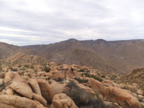
The views over the desert and to the surrounding hills/mountains are gorgeous.


Looking out toward GASP...that's next!


After a little lunch, I headed off the benchmark....straight down. After taking this approach, I don't recommend it for anyone else. Go back the way I came up off the North ridge or some other way....but if you're looking for a serious challenge...along with heightened risk, go down the wash. This looks like an easy way to have come down...


I'm a spelunker at heart, but I'm afraid of caves. I peaked in to see what I could see, but I bolted at the slightest noise.


If you find yourself standing at the bottom of the wash looking up at this, walk away and find another way up. It was a good idea at the moment, but things change.

All in all, this was a fun and relatively easy hike for the more adventurous. Be sure to have thick skin, padding sliding pants and unwaiverable courage. A friend to go along with you would be a good idea as well.
Be safe, enjoy living and appreciate our lands. ~ Joel

Directions and the numbers:
Travel East on I-8 and exit on S2 then turn toward Ocotillo. Drive along this road until just past the Border Patrol Checkpoint and then turn left at Dos Cabeza (a dirt road). Stay on this dirt road until you come to the Dos Cabeza water tower (the small loop above). You can turn right before crossing over the railroad tracks and follow this dirt road for a while, then park and start your journey, or you can park at the water tower for a little extra mileage. Total round trip is appx 5 miles, 2063 total ascent with a max elevation of 5241 ft. Overall this took me about 4 hours.
Copyright: All Rights Reserved
No comments:
Post a Comment